
Our Maps
Our wooden maps begin as an idea. We start with digital elevation models (DEMs) of each maps’ location that are derived from either orthophotogrammetry, or aerial and space-borne laser elevation measurement (LIDAR).
These are obtained at the highest possible spatial resolution from government sources and then seamlessly merged, reprojected, clipped, and mathematically manipulated with several different proprietary, customized mapping and modeling algorithms and map projections to prepare them for three-dimensional modeling.
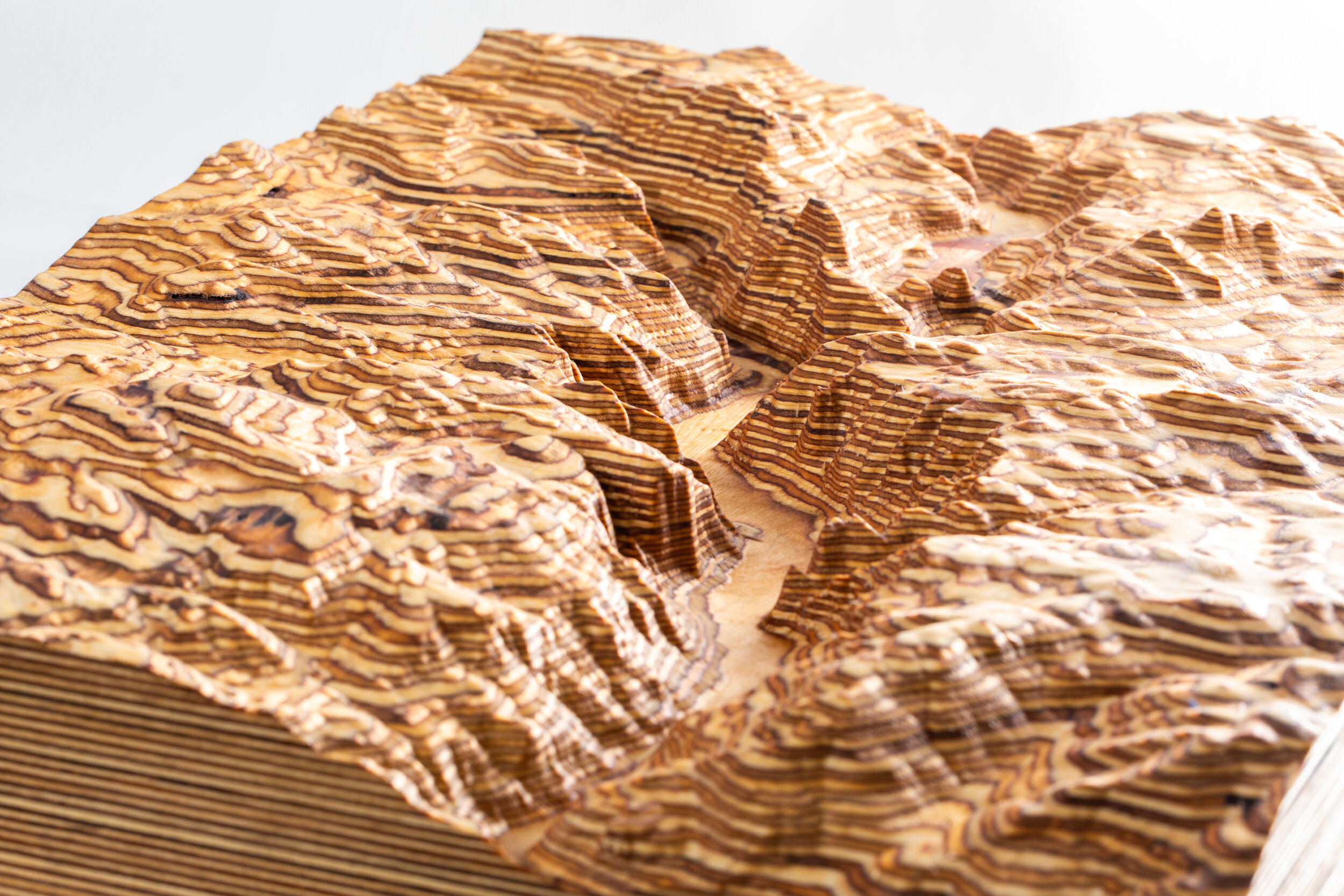
The DEMs are then converted to mesh in the form of a Triangulated Irregular Network (TIN), which itself is then converted into a 3D file that is typically on the order of 2-20 gigabytes, a process that sometimes takes a few days of background computing.
The resultant 3D model is then toolpathed and cut into one of several wood species on a computer controlled (CNC) router system with a suite of different router bits in successively smaller shapes over a period of about a week. Some carves take up to 7 days-worth of continual machining time.
Depending on the presentation, some maps are finished with laser-engraved cartographic labels and topographic details and information.
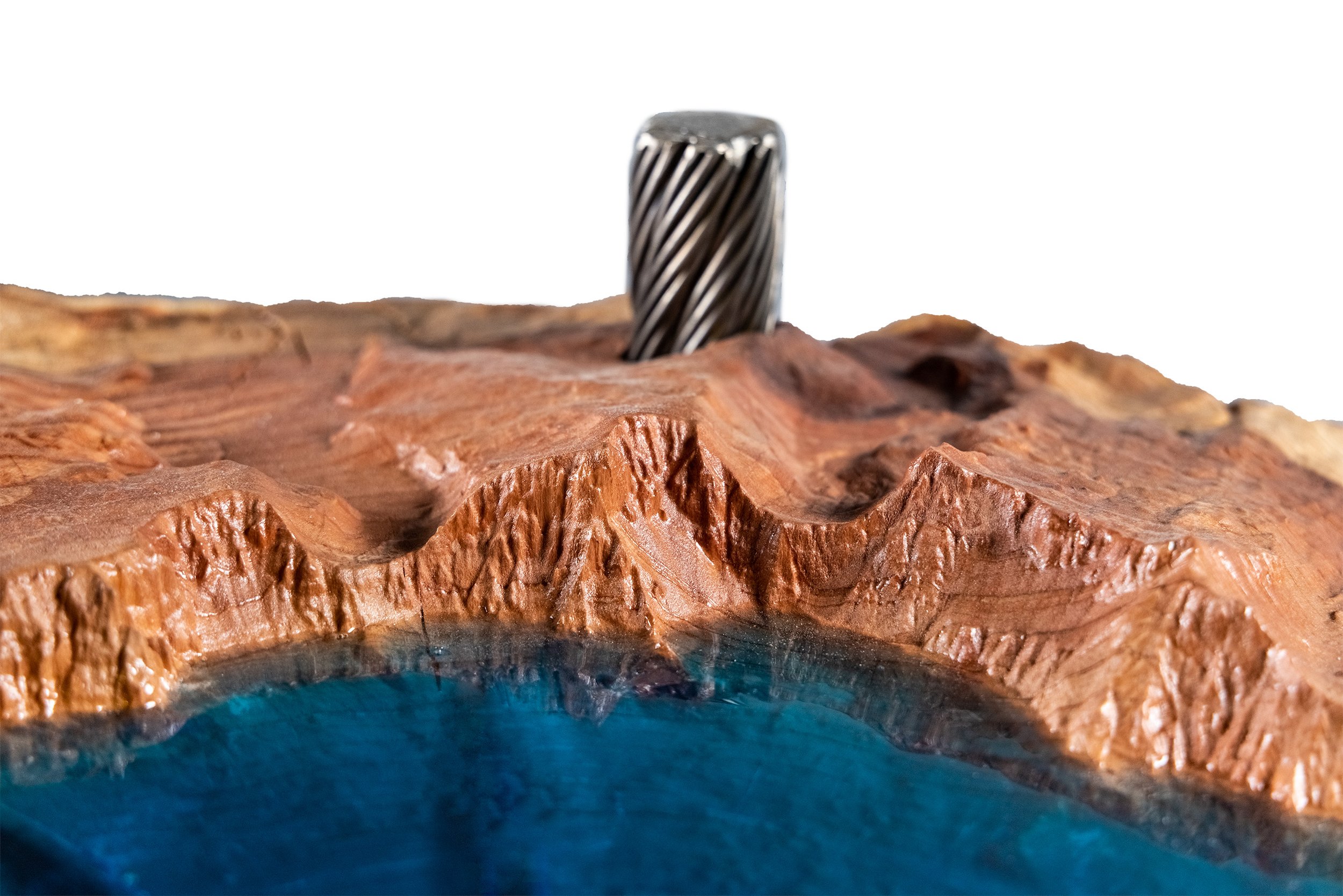
After machining, each piece is carefully sanded by hand and then sealed with all-natural oils, and either framed with hardwood or left unframed for our customers to frame. We use both laminated Baltic Birch plywood and solid custom-milled slabs of soft and hardwoods to create our maps.
We also fabricate custom glass-topped map tables, some created with reclaimed chairlift steel haul rope or logging operation braided steel cable.

Accurate, Intricate, Detailed, Unique
Every single one of our maps is a one-of-a kind, intricately detailed, hand-finished, limited edition custom made work of science and art.
By limited edition, we mean we will only produce a certain quantity of each map. We limit the quantities of our maps because they take so much time to make. Our larger maps can take over a week of 24-hour run time on a CNC machine, followed by another week of hand finishing.
Don’t be fooled into comparing Terra Ligna’s maps to other companies’ mass-produced laser cut products that are cookie cutter copies of maps that have been produced for years; there simply is no comparison to the one-of-a-kind works of art we produce.
When you choose to invest in one of our maps, you are bringing home a custom crafted, truly limited edition, hand-finished work of art that will bring you and your family years of happiness when it brightens your home, and you know there won’t be thousands of them out there in the world.

Tahoe West Shore Backcountry Ski Map

Palisades Tahoe Coffee Table

Mt. Rainier

Mt. Rainier

Palisades Tahoe


Zion in Walnut

Little Cottonwood Canyon

Crater Lake in Redwood
Crater Lake Redwood

Tahoe West Shore

Zion Walnut